Atlas of Bretonnia

Modders' workshop · second door

Understanding the map

How the Season's map goes from Warhammer I to the game, how its expansion to all of Bretonnia is being built, and the technical notebook for working on it: keys, grid, terrain, splits, passes, glossary.

  • The Season: 400 × 440 hexes, 61 regions
  • Saison Expanded: 560 × 825 hexes
  • +32 regions, +11 seas

Two maps

Two maps, two builds

  • In game · private beta

    The Season

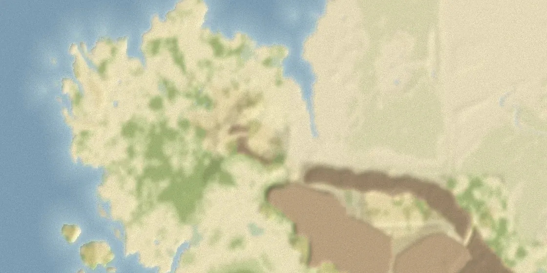
    The map of Warhammer I's mini-campaign, 100% identical: relief, objects, trees, textures, water. 400 × 440 hexes, 61 regions, playable in Warhammer III with its gameplay.

  • On paper · being built

    The expansion

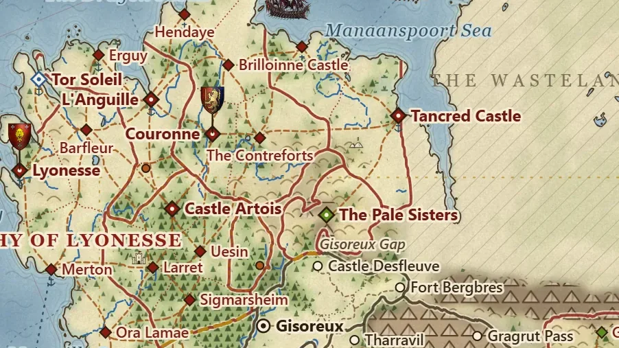
    All of Bretonnia, after the Atlas of the Old World: 32 new regions, 15 provinces and 11 seas. Its in-game build, “Saison Expanded”, began on 25 September.

From Warhammer I to the game

How the Season's map is built

Eight links, from Warhammer I's files to the judgement in game; each one points to the guide that explains it.

  1. linkThe sources

    Warhammer I's mini-campaign: relief, objects, trees, textures, water, texts. These files stay private.

  2. linkThe data

    The game's tables, written by Python scripts, batch by batch, under our keys.

    The RPFM guide →
  3. linkThe logical half

    CAIME: the hex grid and its layers (ground, regions, passable, rivers, roads), validated then exported.

    The CAIME guide →
  4. linkThe visual half

    The terrain in Terry: relief, water, trees, textures, lighting; BOB compiles it, in Charles's workshop.

    The Terry guide →
  5. linkThe pack

    RPFM assembles the pack: tables, scripts, pictures, and the texts in French and English.

    The RPFM guide →
  6. linkThe starting position

    The game generates the startpos from the starting tables: who holds what on turn one.

    The tools →
  7. linkThe tests

    Automated games of 2 to 30 turns, without playing; then the game's logs and crash reports.

    The tools →
  8. linkThe judgement

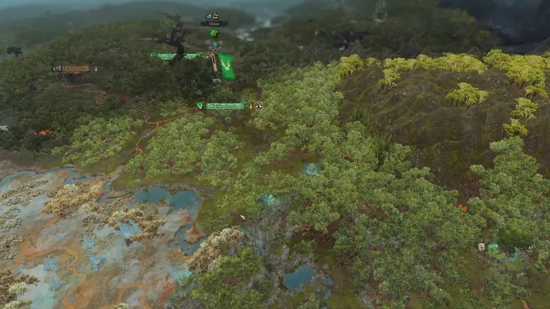
    Charles plays and judges in game, with Warhammer I and Warhammer III screenshots side by side.

Who does what. Charles decides, and judges in game. The work is done with Claude, in several parallel sessions, each in its own area: build, data and scripts, map rendering, illustrations, the expansion's Atlas (the AI guide). An outside contribution comes in through Charles: the path of an idea.

The expansion in the game

Saison Expanded, phase by phase

A copy of the Season, enlarged: the beta stays untouched. In the centre, Warhammer I's map, identical; around it, the Atlas's land; to the south, the Dreaming Wood. The build happens in public.

  1. In progressPhase 1 · One chain, several maps

    Everything that depends on the map gathered in one module; check: no difference across 955 constants for the beta.

  2. In progressPhase 2 · The enlarged grid

    560 × 825 hexes in CAIME, the Season at (x + 120, y + 250); the expansion around it, out of play and impassable; map and campaign declared.

  3. In previewPhase 3 · The expansion's terrain

    Relief, ground, forests, rivers and coasts from the Atlas, and the Dreaming Wood: in preview, not in the game yet.

  4. ComingPhase 4 · The Expanded campaign

    Its key, its startpos, a pack loaded alone, never with the beta's; then a first test in game.

To chain it all by script, we use the command-line commands config, create, import-layer, export-layer, info and sync-names, added to our copy of CAIME, not yet offered to its authors. The whole build, live: Building a map expansion; its code, open: the Season Expanded repository, and the Season mod's.

What comes next

The expansion's work ahead

What it will take for the expansion to exist in game, in order. Help counts at every step.

  1. Settle the map with the community: names, borders, factions, splits, passes (the ideas on the map).
  2. Extend the CAIME layers to the Expanded grid (560 × 825 hexes instead of 400 × 440, with the Dreaming Wood to the south): this is the “Saison Expanded” build, begun on 25 September, in public.
  3. Paint the expansion's terrain: the atlas relief, the drawn eastern range, forests, rivers and coasts, in the image of the current map that came from Warhammer I.
  4. Create regions, provinces, settlements and seas in the game's tables, under our saison_ keys, then the factions and the start position.
  5. Test, fix, repeat: test games, as for the Season.

Settled on 25 September

Key conventions

One simple rule, the same for the beta and for Saison Expanded.

WhatRuleExample
Everything we createprefix saison_, the expansion includedregions saison_<key>, seas saison_sea_<key>, campaign saison_expanded
What comes from Warhammer Iprefix wh_dlc05_, for that onlythe Season's 61 regions, which Saison Expanded shares
Creative Assembly's tablesnever overwritten: the mod adds its own keysthe game's campaigns stay untouched alongside ours
Proposed factionsext_… on the working map, saison_… in the gameext_brt_languille (L'Anguille) will become saison_
NamesGames Workshop's official form in each language, with its source; otherwise “provisional”“The Season of Revelation”, in French « la Saison de la Révélation »

The cards in the map's “For modders” mode still show working keys without a prefix: they will take saison_ when they are declared in the tables. Working data, not published: extension_regions.json (provinces, regions, seas, splits), extension_routes.json (roads, passes, access), carte_papier_v2_donnees.json (places, factions, region grid), aspect_extension.json (each new province's terrain), carte_papier_v2.svg (the map).

Province, sea and faction names follow Total War: Warhammer III's where they exist; the others come from the sources cited on each card, and those found on a single fan map are flagged.

The grid

The map's grid

Logical hexes of the current map: x to the east, y to the north, row 0 in the south. The current map.hex is 400 × 440; the Expanded grid is 560 × 825: all of Bretonnia (560 × 575) and, to the south, 250 rows for the Dreaming Wood. It starts 120 hexes further west and 250 further south: add 120 to current x values and 250 to y values (decided on 25 September; the cards' “new map.hex” refers to it).

  • Regions with a settlement: 57 → 89; provinces: 26 → 41; seas: 2 → 13.
  • Playable land: +51%; 14 proposed splits in the current map; 5 passes to open.

Province by province

The expansion's terrain

For each new province: its measured terrain, relief and climate, the landscape to render, the set dressing to place, and what Creative Assembly already has for these places in Immortal Empires.

The map's “Biomes” base follows CAIME ground types; the “Relief” base gives elevation. High mountains = impassable edge, as in the current map; every new region was checked reachable hex by hex. The terrain should look like that of the current map, which comes from Warhammer I.

Duchy of Lyonesse

4 new regions · plain · temperate climate · 6,750 hexes

grassland 69%, light woods 18%, hills 5%, marsh 5%, dense forest 4%

A ragged coast of headlands and coves facing Lyonen Bay, heaths and salt meadows as far as the eye can see, sparse hedgerows inland; the Dullian Mires to the south. Open, windswept country.

To place in game

  • a ducal castle on a spur above the port of Lyonesse
  • fishing villages, lighthouses on the headlands
  • standing stones and Grail chapels on the heath

In Immortal Empires: Lyonesse exists in Immortal Empires: a large Bretonnian port, capital of the Coast of Lyonesse; Pastures resource, no landmark.

wh3_main_combi_region_lyonesse wh_main_brt_settlement_major_2 wh_main_brt_port_1

Show on the map

Tor Soleil

1 new region · rolling · temperate climate · 466 hexes

grassland 83%, light woods 11%, wooded hills 4%

A grassy headland at the end of the Lyonesse coast, where a High Elf trading enclave still keeps its garrison (The Old World): white towers, marble quays, ships at anchor.

To place in game

  • an elven port: white towers, arches, a marble jetty
  • an elven lighthouse on the point

In Immortal Empires: No Immortal Empires counterpart. For the look: WH3's High Elf ports; the faction of Aislinn, Sea Lord (Tides of Torment), who also holds Tor Martel in this plan.

wh3_dlc27_hef_aislinn

Show on the map

Duchy of L'Anguille

2 new regions · plain · temperate climate · 2,480 hexes

grassland 71%, light woods 18%, marsh 7%, dense forest 4%

A low coast and salt meadows around a great fortified port built on the ruins of Tor Alessi, the old elf city; the Mourning Meadows to the east, a few woods inland.

To place in game

  • a fortified harbour and shipyards
  • elven remnants in the walls (Tor Alessi)
  • windmills on the meadows

In Immortal Empires: L'Anguille exists in Immortal Empires, held by Mousillon: a Bretonnian-looking minor port; landmark: Svengar's Cairn (a CA Norscan addition).

wh3_main_combi_region_languille wh_main_brt_settlement_minor_1 wh3_dlc27_nor_special_svengars_cairn

Show on the map

Duchy of Couronne

4 new regions · rolling · temperate climate · 6,742 hexes

grassland 53%, light woods 23%, hills 12%, dense forest 9%, wooded hills 2%

The heart of the kingdom: fields, orchards and well-kept woods around the royal capital, its lists and chapels; to the south-east the hills of the Contreforts rise toward the Pale Sisters.

To place in game

  • Couronne: the royal palace and the Abbey of the Grail Companions (CA landmark)
  • tournament grounds, pavilions and lists
  • Grail chapels and wayside shrines at crossroads
  • orchards and vines on the Contreforts slopes

In Immortal Empires: Couronne is the royal capital in Immortal Empires: a special settlement chain, landmarks Abbey of the Grail Companions and Couronne Tournament Grounds; no port. Pottery resource.

wh3_main_combi_region_couronne wh_main_special_settlement_couronne wh_main_brt_legendary_grail_abbey wh_main_special_tournament_grounds

Show on the map

Marches of Couronne

2 new regions · plain · temperate climate · 3,862 hexes

grassland 60%, light woods 20%, dense forest 8%, marsh 7%, hills 3%, wooded hills 2%

A border march facing the Wasteland: open grassland, scattered woods and copses, the Le Mollier and Theronde marshes toward the coast; watchtowers and guard castles.

To place in game

  • watchtowers and border forts
  • fortified coastal towns
  • reed beds in the marshes

In Immortal Empires: The Marches of Couronne faction only exists in Realm of Chaos; in Immortal Empires the Marches of Couronne province groups Couronne and L'Anguille.

wh3_dlc20_brt_march_of_couronne

Show on the map

Duchy of Artois

4 new regions · rolling · temperate climate · 5,997 hexes

dense forest 45%, light woods 40%, grassland 13%

The Forest of Arden covers almost the whole dukedom: tall woods, glades and paths, isolated castles; to the south, the Imperial outpost of Sigmarsheim.

To place in game

  • a fortified ducal castle in a wide glade
  • forgotten Grail shrines in the woods
  • the palisade and watchtower of the Imperial outpost of Sigmarsheim

In Immortal Empires: Castle Artois exists in Immortal Empires: a large Bretonnian town, capital of the Forest of Arden; Timber resource, no landmark.

wh3_main_combi_region_castle_artois wh_main_brt_settlement_major_2

Show on the map

The Pale Sisters

1 new region · highlands · temperate climate · 1,683 hexes

hills 51%, wooded hills 18%, mountain 13%, grassland 12%, dense forest 3%, light woods 3%

Two masses of pale, gullied hills between Couronne and Gisoreux; gorges and caves where the greenskin tribes nest.

To place in game

  • an orc camp behind palisades
  • Gork and Mork idols, skull totems
  • caves and scree

In Immortal Empires: No Immortal Empires counterpart; the nearest region is Fort Bergbres, in the Gisoreux Gap.

wh3_main_combi_region_fort_bergbres

Show on the map

Northern Grey Mountains

1 new region · highlands · mountain climate · 2,140 hexes

hills 58%, wooded hills 16%, mountain 12%, grassland 8%, dense forest 5%

A high valley beneath the Grey Mountain ridges, alpine pastures and scree; Grung Zint, a dwarf-looking settlement CA gives to the Skullsmasherz.

To place in game

  • a rock-hewn dwarf gate, defaced by orcs
  • orc totems on the ramparts
  • marble quarries

In Immortal Empires: Grung Zint exists in Immortal Empires: capital of the Skullsmasherz (Northern Grey Mountains), a dwarf-looking greenskin minor settlement; Marble resource.

wh3_main_combi_region_grung_zint wh_main_dwf_settlement_minor_2

Show on the map

Reikland

2 new regions · rolling · temperate climate · 6,375 hexes

grassland 31%, light woods 27%, dense forest 19%, mountain 10%, hills 7%, wooded hills 5%

The Imperial side of the passes: wooded valleys at the edge of the Reikwald, hills and torrents; Helmgart bars the Axe Bite Pass, Ubersreik guards the mouth of the Grey Lady Pass.

To place in game

  • an Imperial fortress barring the pass (Helmgart)
  • a half-timbered Imperial town; the Red Moon Inn (CA landmark)
  • coaching inns and milestones on the pass road

In Immortal Empires: Helmgart is an Imperial fort in Immortal Empires (the only region of the Axe Bite Pass); Ubersreik, in the Reikland, has the Red Moon Inn landmark.

wh3_main_combi_region_helmgart wh2_main_special_empire_fort_emp_1 wh3_main_combi_region_ubersreik wh_main_special_ubersreik_inn_1

Show on the map

Duchy of Parravon

1 new region · highlands · temperate climate · 1,803 hexes

hills 40%, mountain 15%, wooded hills 15%, light woods 11%, grassland 11%, dense forest 8%

High meadows of the Grey Mountains, in Parravon, where the abbey of La Maisontaal guards relics coveted by Heinrich Kemmler (its place on the map: the project's choice, at the foot of the Grey Lady Pass).

To place in game

  • the abbey of La Maisontaal on a knoll
  • pilgrim paths and calvaries

In Immortal Empires: La Maisontaal is not a region in Immortal Empires: it is a named map location and Kemmler's quest battle for his staff.

wh3_main_ie_la_maisontall_abbey qb_wh_main_la_maisontaal_abbey

Show on the map

Grey Lady Pass

2 new regions · mountainous · mountain climate · 1,975 hexes

mountain 59%, hills 23%, wooded hills 9%, dense forest 8%

The great pass of the Grey Mountains between Bretonnia and the Empire: alpine meadows, pine forests and gorges; Karak Azgaraz, King Thuringar's inhabited dwarf hold, commands its entrance; the Bleeding Moon goblins prowl around it (Archives of the Empire I, pp. 70-71).

To place in game

  • a guarded monumental dwarf gate in the cliff (Karak Azgaraz)
  • the pass road, stone bridges and hairpin bends
  • goblin lairs in the gorge caves

In Immortal Empires: Karak Azgaraz exists in Immortal Empires, abandoned: a minor dwarf ruin in the Southern Grey Mountains (the expansion makes it inhabited, as in the lore).

wh3_main_combi_region_karak_azgaraz wh_main_dwf_settlement_minor_ruin

Show on the map

Southern Grey Mountains

3 new regions · mountainous · mountain climate · 3,264 hexes

mountain 67%, hills 21%, wooded hills 7%, dense forest 5%

High plateaus and deep valleys beneath the peaks: Karak Norn, a great dwarf hold, and Grimhold further south, linked by a mountain road (the atlas's Durak Way, with no source); the Red Nails goblins, Karak Norn's neighbours, prowl between them (Lords of Stone and Steel, pp. 27-29).

To place in game

  • dwarf hold gates, mines and furnaces
  • bridges and stairs cut into the rock
  • the Red Nails goblin camp in the scree

In Immortal Empires: Karak Norn (capital of the Southern Grey Mountains, a large dwarf hold, Furs resource) and Grimhold (a minor dwarf settlement) exist in Immortal Empires, held by Karak Norn.

wh3_main_combi_region_karak_norn wh_main_dwf_settlement_major_1 wh3_main_combi_region_grimhold

Show on the map

Irrana Mountains

2 new regions · rolling · temperate climate · 3,193 hexes

grassland 29%, hills 21%, light woods 21%, dense forest 13%, wooded hills 9%, mountain 7%

The foothills of the Irrana Mountains south of Carcassonne: dry plateaus, rocky hills and light woods, where the greenskin tribes war endlessly with the knights; on the northern slopes, the Iron Orcs, whom only the Carcassonnais ever see (Knights of the Grail, pp. 64-65).

To place in game

  • greenskin camps, palisades and totems
  • ruined Bretonnian watchtowers

In Immortal Empires: In Immortal Empires the Irrana Mountains province (Bilbali, Montenas) is Estalian, without greenskins; the nearest are Brionne (Red Cloud) and the Massif Orcal (Broken Axe).

wh3_main_combi_region_brionne wh3_main_combi_region_massif_orcal

Show on the map

Tor Martel Isles

2 new regions · highlands · temperate climate · 876 hexes

wooded hills 33%, light woods 21%, hills 18%, grassland 16%, dense forest 12%

Two wooded isles off Mousillon, hills and coves; on the larger one, in sight of Mousillon's walls, the fortress of Aislinn, Sea Lord (Arcane Journal: High Elf Realms).

To place in game

  • an elven fortress: white towers, jetties, a shipyard slip
  • an elven lighthouse facing Mousillon

In Immortal Empires: No Immortal Empires counterpart: these isles come from The Old World's official map. Aislinn's faction exists in WH3 (Tides of Torment DLC), as a naval horde in Immortal Empires.

wh3_dlc27_hef_aislinn

Show on the map

The Silent Isle

1 new region · rolling · temperate climate · 182 hexes

dense forest 34%, wooded hills 29%, light woods 28%, grassland 9%

A forest-covered isle in the Gulf of Bidouze that sailors avoid. In The Old World, the largest High Elf garrison outside Ulthuan (Arcane Journal: High Elf Realms, p. 36); in Warhammer III's era, a Bretonnian fief whose boats and people vanished in a single night (Knights of the Grail, pp. 59-60).

To place in game

  • elf ruins swallowed by the forest (the project's choice)
  • mists and reefs around the isle

In Immortal Empires: No Immortal Empires counterpart: an isle from The Old World's official map.

Show on the map

To keep or not

Proposed splits

Large regions, cut around a place the lore puts inside them.

Eleven in the Season's map (the Massif Orcal into three), three in the new part. Dashed orange on the map (“Splits” layer); to keep or not, one by one.

ShowHost regionNew regionSourceNew / restWhy
Chateau D'Epee
Duchy of Aquitaine
AquitaineCA, WH3 (an Immortal Empires region); 2eKotG pp. 47-48 (the dukedom's capital)956 / 1,500the missing Immortal Empires town, the dukedom's capital in Knights of the Grail, “in the south of the dukedom”: in the south of the region (the west, where the atlas puts it, is taken by Chateau D'Epee); Mercal stays a named place, near Ceren Field
Gien
Duchy of Aquitaine
Ceren FieldThe Red Duke novel (Black Library); Circle of Blood; Vampire Counts 7th ed., p. 261,120 / 713the field of the Red Duke's two battles and Galand's tomb-chapel, carved out of Gien: the Ceren Field named place, at the centre of the Season's script zone, falls inside (not the whole zone); the Tomb of the Red Duke, his marble tower, stays at Gien; no source places the field (a placement choice)
Massif Orcal
Massif Orcal
Viefin2eKotG pp. 88-89775 / 1,233a chartered town of Quenelles with enormous walls, at the end of the Axe Bite Pass road: a stronghold facing the orcs of the Massif (7 hexes east of the atlas point, to keep its distance from the towns)
St Jacques
Duchy of Carcassonne
Dragon Falls2eKotG pp. 64-651,295 / 2,690a fortress where the Vaults meet the Irrana, claimed by Carcassonne: the southern frontier, facing the tribes; no official French form found
Castle Carcassonne
Duchy of Carcassonne
Burial Mound of GrudsnikCA (a named place and quest battle in Immortal Empires)1,255 / 1,948the Immortal Empires named place, south-east of Castle Carcassonne: a greenskin lair at the heart of the dukedom (a named place in Immortal Empires, not a region)
Massif Orcal
Massif Orcal
Crac de SangThe Red Duke novel, ch. 6 (Black Library)1,015 / 1,233the Red Duke's fortress, on a hill above the Morceaux and the Forest of Châlons, taken in 1454: retaking it is his goal; the Broken Axe (Grom the Paunch's faction), the orcs of the Massif Orcal it is carved out of, hold it at the start (placement: a choice)
Summersfall Fort
Glanborielle
Château Lovarre2eKotG (Carcassonne sidebar)993 / 2,759a chartered town of Carcassonne, facing Athel Loren; the atlas puts it in the impassable forest south of Summersfall Fort: 14 hexes further north
Castle Bastonne
Duchy of Bastonne
Castle Sangasse2eKotG pp. 16, 54-56452 / 822a chartered town of Bastonne, between Bastonne and Montfort (11 hexes east of the atlas point); Garamont, the dukedom's other chartered town, has no room
Quenelles
Duchy of Quenelles
Marguilles1eDDS1,015 / 1,601fills the gap between Quenelles, Montlac and Laguiller (placement: a choice)
Crag Halls of Findol
Wydrioth
Druthandor GateWAWE8E689 / 2,287the host region, Crag Halls of Findol, is 2,976 hexes: the Gate takes 689
Tal Amere
Atylwyth
Tal MoraWAWE8E533 / 1,502the host region, Tal Amere, is 2,035 hexes: Tal Mora takes 533
Castle Artois
Duchy of Artois
Grasgar Castle2eKotG pp. 41-46638 / 959seat of the Duke of L'Anguille; a chain of signal towers along the forest raises the alarm there; the atlas puts it inside the Castle Artois region: the L'Anguille border moves south (moved off the atlas point to keep its distance from the towns)
Uesin
Duchy of Artois
Oisillon1eCRB; 2eKotG pp. 70-73794 / 1,009a great castle “about 100 miles north” of Gisoreux: north of the city, on the new land; the map's scale in miles is not established
La Maisontaal
Duchy of Parravon
Sanglac Castle2eKotG p. 871,062 / 741a chartered town of Parravon: an abandoned castle in the heart of the Grey Mountains, a ruin to rebuild on the pass road (indicative placement: the eastern fit is artificial)

Source codes: 2eKotG = WFRP 2nd ed., Knights of the Grail; 1eCRB = WFRP 1st ed., core rulebook; 1eDDS = WFRP 1st ed., Death's Dark Shadow; WAWE8E = Wood Elves army book, 8th ed. (WFRP: Warhammer Fantasy Roleplay).

In the mountains

Passes to open

So that the passes lead somewhere.

A few short breaches to dig in the impassable edge of existing regions (the current map's Impassable layer).

ShowPassLinksHexes to open
Axe Bite Pass, Imperial sideKarak Ziflin → Helmgart16
Grung Zint ValleyAxe Bite Pass → Grung Zint3
Blackstone TrailBlackstone Post → La Maisontaal (Kemmler and the abbey)10
Pine CragsKarak Norn → Tal Jul-Finel (the dwarfs' road of 1350 IC)12
Iron Orc BreachThe Iron Orcs → Carcassonne2

From the atlas to the page

How the expansion map was drawn

  • Main source: Todd Kozlowski's Atlas of the Old World (a non-commercial fan project), drawn after Andy Law's maps (Warhammer Fantasy Roleplay), Émile Beguin's Bretonnia and Games Workshop's books (Knights of the Grail, the Wood Elves army book); the Tor Martel isles and the Silent Isle from The Old World's official map.
  • Alignment: a smooth warp (moving least squares) on 48 towns shared by the atlas and the Season map.
  • The east redrawn: the Warhammer I map enlarges Athel Loren and pushes the Grey Mountains east; the eastern range and its passes (Axe Bite Pass, Grey Lady Pass, Grung Zint valley, Wut pass, Durak's Way) were therefore drawn from the lore's topology: what touches what, through which pass.
  • Rivers: kept only if they end in the sea, at the map's edge or on a river of the current map: none enters the map only to vanish.
  • Regions: towns named from the lore, with their source, grown over land along the cheapest paths (high mountains and rivers cost more); each region in one piece.
  • Roads and access: the cheapest path between neighbouring towns; every new town reachable over land, except the isles (sea links).

The whole method: All of Bretonnia.

The project's words

Glossary

The words of the Season, the map and the build. Each tool's own words are in its guide.

The project

The Season of Revelation
Warhammer I's Wood Elf mini-campaign (Realm of The Wood Elves DLC, 2016), which this project makes playable in Warhammer III.
Saison Expanded
The Season's map enlarged to all of Bretonnia, on a 560 × 825 hex grid; a copy: the beta stays untouched.
The expansion
All of Bretonnia, drawn on the site's map after the Atlas of the Old World; Saison Expanded builds it in game.
Immortal Empires
Warhammer III's grand campaign. We don't cut its map up: we keep Warhammer I's.
The Dreaming Wood
Athel Loren's reflection, south of the Saison Expanded grid, behind an impassable veil; an addition of the project, after the Wood Elves army book (8th edition).
The lore
The Warhammer world as Games Workshop's books write it. The project's rule: nothing made up.
Provisional
A name with no official form found yet, flagged as such on the map, until a source turns up.
The beta
The version of the Season played by volunteers: private, invitation only, requested on Discord.

The map

Hex
A cell of a campaign map's logical grid. Here, x to the east, y to the north, row 0 in the south.
map.hex
The logical grid's file, edited with CAIME: the Season is 400 × 440 hexes, Saison Expanded 560 × 825.
Layer
A piece of information set hex by hex: ground type, climate, passable, rivers, roads, beaches, bridges, regions.
Region
A cell of the political map, usually with its settlement. The Season's map has 61.
Province
A group of neighbouring regions, with its capital.
Settlement
A region's town, minor or major.
Split
A large region cut around a place the lore puts inside it: a proposal, to keep or not.
Pass to open
A short breach to dig in an existing region's impassable edge, so that a pass leads somewhere.
Impassable edge
The high mountains that close the map, as in Warhammer I's.
Playable area
The part of the map you play on; beyond it, scenery, under the fog.

The build

Pack
A mod's file, which the game loads; RPFM opens and writes it.
Table, key
The game's data is stored in tables; each row has its key. Ours start with saison_.
Startpos
A campaign's starting position, which the game generates from the starting tables.
Assembly Kit
Creative Assembly's official modding tools: among others, Terry and BOB.
CAIME
Campaign AI Map Editor, the Campaign Map Toolkit's editor: a map's logical half.
Terry, BOB
The Assembly Kit's terrain editor, and the builder that compiles what it produces.
RPFM
The community-made tool for packs and tables.
Automated test
A game played by the game's AI for a few turns, to check that no turn stalls or crashes.
↑ Contents